
This Borders on Being Triply Awesome
CT-MA-RI Tri-point, Thompson
June 3, 2011
I revisited this tri-point with my sons in 2016. Very different report and better pictures!
On the hike out to the CT-MA-NY tri-point, the trail hits the highest point in Connecticut (CTMQ Visit here). On the way out to the CT-NY-RI tri-point – oh, you didn’t know about that one? Here it is. (And notice that if you take the ferry to Block Island from New London, you just about hit it! Next time we do that, I’m going to request the ferryman makes my day and nudges the boat a little to the right for me.)
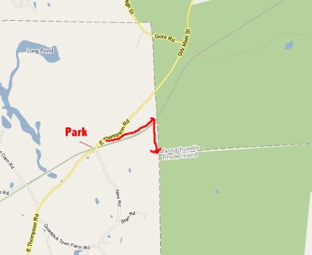
And if you hike to the CT-MA-RI tri-point, you’ll walk along the rail bed of one of the more infamous events in the history of the US. Not that I have to tell you, but the main trail to the tri-point is the rail bed on which the Great East Thompson Train Wreck occurred in 1891! The only time in US railroading history that FOUR trains crashed into each other! And by seeking out the tri-point, you’ll stand at the area by default. (CTMQ report here).
Someone really should put up a plaque about the train wreck.
There are other routes to this tri-point from other starting points, but I’ll present the easiest and most straight-forward. Believe it or not, there are books and websites out there for people who seek out all the tri-points around the country. The problem with these books (and probably this page on CTMQ in a few years) is that these things change. Not the points themselves, but the trails/routes to get there.
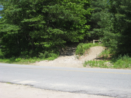
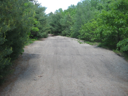
However, I’m pretty confident about the route I took and its durability. First, find your way to Thompson, CT. Use whatever means you use to get to the intersection of East Thompson Road and New Road. There, you can park in the sandy shoulder/lot thing across from the sandy trail with the yellow gate. This is what that looks like:
Exciting, right? I know I was darn excited. And if you think I’m kidding, you don’t know CTMQ.
There are other descriptions of how to get to the tri-point and you’ll immediately find them outdated once in the woods. There are more trails crossing the trail I’m describing than in any book or website I saw. The CT DOT site from 1997’s perambulation suggests a route that is now a private drive, so that won’t work (though it does get you right up to the bottom of the hill the tri-point stands on). So here’s what you do:
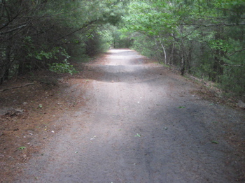
Walk across the road, past the yellow gate and you’ll find yourself on a pin straight former rail bed. Walk straight. (Or jog if you just can’t wait like me.)
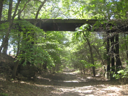
After about a quarter mile, you’ll pass underneath an old railroad trestle bridge. Scurry up to check out the view from the top. How could you not? Bumble back down to your perfectly flat and straight trail.
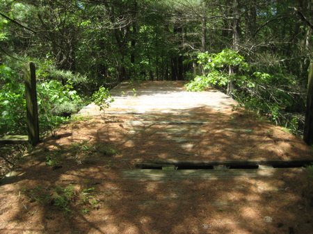
Except you’ll notice the trail surface is not at all flat as somehow the entire way is like a little rollercoaster. I don’t know if this is natural or not, but it gets pretty annoying after a while. It’s like walking a nice wave function all the way to Massachusetts. You can’t really jog or run over them and after walking on these undulations for 15 minutes, it reminded me of just bobbing in the surf at the beach. It was apparent ATV’s ride these trails fairly often – and I can’t imagine how annoying that is. (Perhaps they are purposeful to ward off motorized traffic?)
2015 Update: According to my friend Linda Orlomski, the trail has been flattened and no longer will give you motion sickness.
You’ll pass a couple crossing trails along the way. As of this writing the second crossing trail after the bridge will get you to the tri-point if you follow the correct forks. But skip it. Trust me. Just keep walking along the old rail bed.
Maybe two-thirds of a mile from the beginning, you’ll see a familiar CT-MA border monument on the right hand side of the old rail bed trail! Now we’re in business!
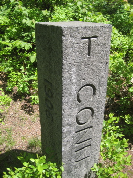
Gaze upon the boundary marker and revel in its glory. In official perambulation speak, this is boundary marker 2. (Markers start at A down at the CT-RI border in Stonington, run through O which is the tri-point, then the border with MA starts with 1 – at this same tri-point north, then west to the CT-MA-NY tri-point which is 199. Then, you guessed it, they start at 1 again at the NY-MA-CT tri-point down south to 170 at Long Island Sound on the NY border. I love how I just got you to read that.)
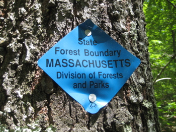
At marker 2, right on the rail bed, you’ll notice a blue-blazed trail heading due south. Follow that. The blue blazes – most of them anyway – mark Massachusetts state forest land. But the trail is a real trail that follows the border south. There are also MA Forest boundary signs tacked into a few trees along the way.
As I walked the trail, I began wondering how far it goes. That is, can I follow this unofficial trail all the way around the state? Knowing, of course, that the border crosses through much private property and doesn’t stick to nice trails through woods… but I still think it’s doable. The DOT is tasked with checking on the health of every single boundary marker – all 384 of them – every 10 years or so. Where can I sign up for that job? That’s like 374 little mini treasure hunts! Oh man, that would be awesome.
For now, I was only interested in finding one more marker after # 2. That would be #1 or O depending on your direction. The trail was easy to follow and again, maybe only another quarter mile. Another huge advantage to this border trail route is that the final push up the hill to the tri-point is about a tenth of the effort as it is coming up from Connecticut.
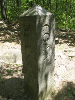
There it is! Gleaming in the sunlight on top of the little hill in the woods! The CT-MA-RI tri-point marker! What you’ll notice is that this granite marker has a little pyramid on top, denoting its vast importance. In official-speak:
Bound is located on the southwestern slope of a wooded hill, 45 feet north along the crest from the south end of a sharp break, and about halfway up the steep hillside.
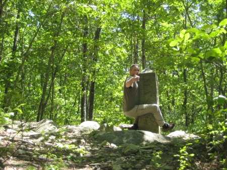
A granite monument, showing 3.9 feet above the ground, marks the bound. It is 14 inches square with a pyramidal top and is lettered “MASS 1883” on the north face, “RI 1883” on the south face and “CONN” on the west face. The lettered sides are dressed. The east side rock is faced. It is 9 feet long to the base from the 6 inch pyramidal top. Monument was set in October, or November, of 1883 by a Massachusetts-Rhode Island commission.
The 1941 commissioners accepted the monument as correctly marking the northerly end of the line established in 1840.
I’m swooning. You can return to your car the way you came or make a small loop of things and head down the steep hill in front of you then go due north and stay on the trail that continues north, eventually hitting the rail bed trail after a few minutes. (If you venture west, you’ll get all messed up with a swamp and a creek like I did. Don’t try to get cute.)
DOT Perambulation, the greatest thing ever.